
What to see in Pego
Pego sits in a valley ringed by mountains at the northern edge of Alicante province, on the border between the Marina Alta and the Safor district. The town was founded in the late 13th century on the site of an earlier Islamic settlement, Uixola, shortly after James I conquered the valley in 1244 through a pact with the local leader Al-Azraq.
History
In 1262, Infante Pedro created the barony of Pego, and centuries later, during the War of the Spanish Succession, the town served as a military base for Felipe V's troops, earning it the title "Muy Noble Villa." Remnants of that defensive past include the Castell d'Ambra, on the high ground surrounding the town, while inside the old quarter the Iglesia Arciprestal de la Asunción and the Capilla Ecce Homo round out its religious heritage.
What to see
Pego's main natural draw is the Marjal de Pego-Oliva, a former lagoon now silted up and turned into a mosaic of rice paddies crossed by irrigation channels. Water arrives through several "ullals" — karst springs fed by the aquifers of the Mostalla and Segària mountains — and feeds the Bullent and Racons rivers, which in turn sustain one of the Valencian Community's most important wetlands for birds: herons, coots and grebes are common for much of the year. The Muntanyeta Verda viewpoint, a small hill just 49 metres high inside the natural park, takes in the sea, the Montgó mountain and the patchwork of rice fields all at once; access can be restricted at certain times of year under bird-of-prey protection programmes, so it's worth checking before planning a visit.
Pego's food centres on rice: Arròs en Costra, baked until it forms a thin golden crust, is the town's signature dish, alongside eel all i pebre stew and the duck-and-eel paellas typical of the wetland area. The Moros y Cristianos festival, with thirteen filaes split between Christian and Moorish sides, fills the last weekend of June with parades. Pego pairs well with a visit to neighbouring Jalón for anyone touring the Marina Alta interior on the same trip. The Xillibre peak, at 729 metres, is the highest point in the municipality and dominates the mountainous skyline around the Pego depression. Rice cultivation in the marjal reached its historical peak of more than 900 hectares in 1945, and today the municipality, home to around 10,800 people, keeps an agricultural economy that also relies on irrigated citrus groves.
🚆 How to get there from Alicante
Pego lies inland in the Marina Alta, close to the border with the Safor district, a little over an hour's drive from Alicante. The most direct route follows the AP-7 motorway to the Ondara exit and continues on a regional road inland, or the N-332 with local turn-offs for drivers avoiding the toll. There's no train station in the municipality, and interurban bus connections from Alicante are limited, usually requiring a change in Denia or Ondara, so a car is the most practical way to get there and to get around the natural park afterward. Cyclists sometimes combine the drive with a stop in Ondara, using it as a base for exploring the flatter roads around the natural park.
Compare all towns by transport →
-
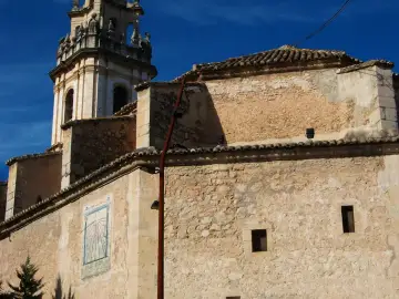 ChurchIglesia Arciprestal de la AsunciónPego — Marina Alta (Alacant)
16th-century Renaissance church built 1599–1614 on the ruins of a mosque.
-
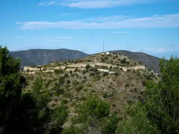 CastleCastell d'AmbraPego — Marina Alta (Alacant)
13th-century Islamic fortress on a hill 264 metres high. Double-walled enclosure designed to protect the settlement, with well-preserved…
-
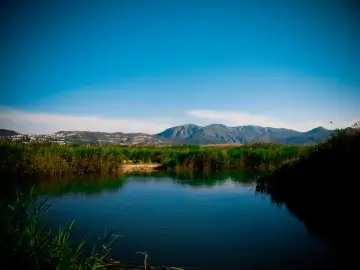 Beach & nature · FREEMarjal de Pego-OlivaPego — Marina Alta (Alacant)
Natural park covering 1,255 hectares, established 1994. Former lagoon with traditional rice cultivation; refuge for the Samaruc, an…
-
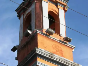 ChurchCapilla Ecce HomoPego — Marina Alta (Alacant)
18th-century Baroque chapel with octagonal floor plan topped by a glazed-tile dome.
- 🏰Castle · FREECastell de les AtzavaresPego — Vall de Laguar
Medieval fortress clinging above the Girona river gorge in consolidated ruin, reached only via anchored chains and a suspended parade…
Frequently asked questions
What can you see at the Marjal de Pego-Oliva?
A landscape of rice paddies and channels fed by natural springs, with birdwatching spots for herons and coots, plus the Muntanyeta Verda viewpoint.
What's Pego's signature dish?
Arròs en Costra, rice baked until it forms a thin golden crust, is the town's most representative dish.
When does Pego celebrate Moros y Cristianos?
On the last weekend of June, with thirteen filaes split between Christian and Moorish sides.